Unlocking Field Mapping Potential with UAVs and Photogrammetry
Discover how photogrammetry combined with advanced UAVs, cameras, and software are advancing field mapping for agriculture and industry.
The Role of UAVs in Modern Field Mapping
Unmanned Aerial Vehicles (UAVs) have emerged as a transformative tool in the realm of field mapping. Together, they offer unprecedented access to aerial perspectives, providing high-resolution imagery that is crucial for various applications, from agricultural planning to industrial inspections. UAVs eliminate the need for costly and time-consuming ground surveys, enabling rapid data collection over large areas. This efficiency not only saves time but also significantly reduces operational costs, making it an attractive option for businesses and researchers alike.
Moreover, the ability of UAVs to capture data from difficult-to-reach locations ensures comprehensive coverage that ground-based methods simply can't match. Whether it's mapping a vast agricultural field or inspecting industrial infrastructure, UAVs are proving to be indispensable. Their integration with advanced photogrammetry software further enhances their capabilities, allowing for the creation of detailed and accurate maps that inform critical decision-making processes.
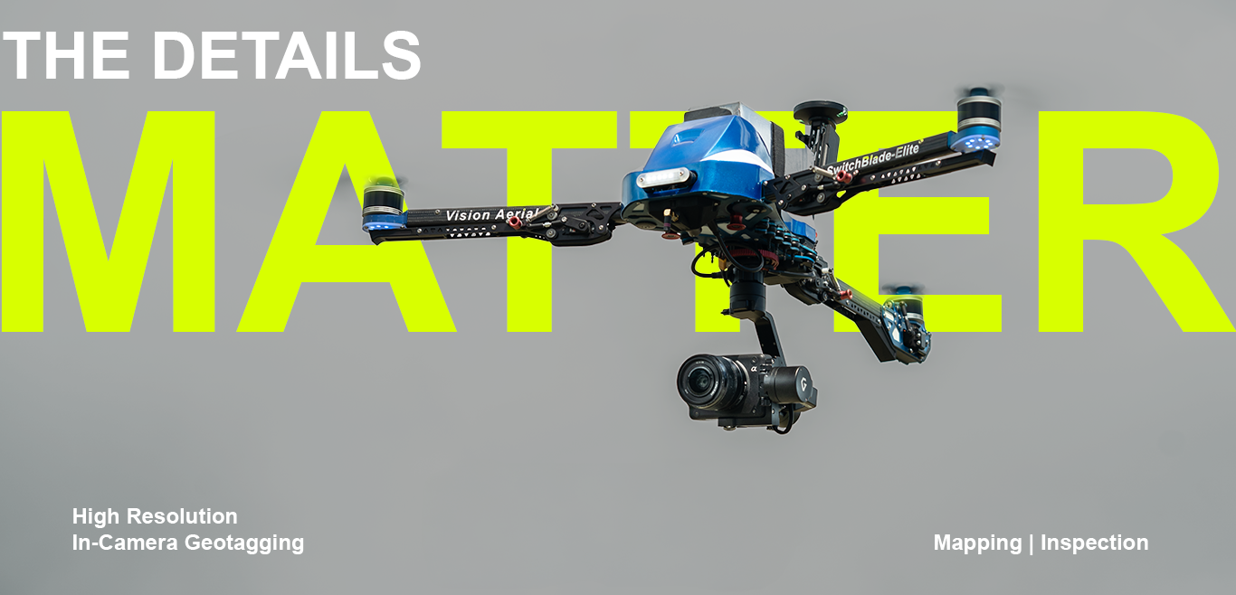
Why the SwitchBlade-Elite is Ideal for Aerial Surveys
The Vision Aerial SwitchBlade-Elite is a standout for high-performance aerial surveys. This tricopter drone is built to withstand challenging conditions, including high wind environments, which ensures stability and reliability during flights. Its ability to carry payloads up to 2.0 kg, combined with a flight range of over 16 kilometers and a maximum flight time of up to 50 minutes, makes it an exceptional choice for extensive field mapping projects.
One of the key features of the SwitchBlade-Elite is its rapid deployment capability. The drone can be operational in under two minutes, maximizing time spent on actual data collection. This efficiency is crucial for large-scale projects where time is of the essence. Additionally, the SwitchBlade-Elite's compatibility with various payloads, including advanced cameras and sensors, allows for a customized approach tailored to specific mapping needs.
Harnessing the Power of the Sony ILX-LR1 Camera
The Sony ILX-LR1 camera is a game-changer in the field of industrial imaging. Featuring a 61-megapixel full-frame sensor, this camera delivers unparalleled image quality with exceptional detail and dynamic range. Its compact and lightweight design makes it an ideal companion for the SwitchBlade-Elite, enhancing the UAV's operational efficiency without compromising on performance.
The ILX-LR1 has several standout features, including in-camera geotagging, which integrates GPS data into each image. This functionality ensures precise location tracking, which is essential for accurate aerial mapping and industrial inspections. The camera's USB 3.2 connectivity allows for fast data transfer, seamlessly integrating into existing workflows and ensuring that data is readily available for analysis.
How PIX4Dfields Enhances Photogrammetry Workflows
PIX4Dfields software is a powerful tool designed to optimize the use of photogrammetry in agriculture and industry. This hybrid drone and satellite mapping software facilitates rapid processing of aerial imagery, providing actionable insights that drive decision-making. One of the most significant advantages of PIX4Dfields is its ability to create maps both in-field and in-office, allowing for real-time analysis and faster response times.
The software is equipped with unique tools that transform raw images into valuable data. Users can generate crop health maps, field reports, and prescription maps for agricultural machinery, all of which contribute to more efficient resource management. The easy sharing capabilities of PIX4Dfields further enhance its utility, enabling users to distribute data via PDF reports and industry-standard formats seamlessly.
Practical Applications: From Irrigation to Fertilization
The combination of the Vision Aerial SwitchBlade-Elite UAV, Sony ILX-LR1 camera, and PIX4Dfields software opens up numerous practical applications in agriculture. For example, the integrated technology can be used for precision monitoring of irrigation, ensuring that water is distributed efficiently across fields. By analyzing crop health maps, farmers can identify areas that require more or less water, optimizing water usage and improving crop yields.
Fertilization is another area where this technology excels. By creating detailed prescription maps, farmers can apply fertilizers precisely where needed, reducing waste and enhancing productivity. This precision agriculture approach not only saves costs but also promotes sustainable farming practices by minimizing the environmental impact.
Maximizing Efficiency and Accuracy in Field Mapping
Efficiency and accuracy are paramount in field mapping, and the integrated use of the SwitchBlade-Elite UAV, Sony ILX-LR1 camera, and PIX4Dfields software ensures both. The UAV's rapid deployment and extended flight capabilities allow for extensive data collection in a short period. The high-resolution imagery captured by the ILX-LR1 provides detailed information, while PIX4Dfields processes this data into actionable insights quickly.
This combination enhances decision-making in various applications, from agricultural planning to industrial inspections. By leveraging advanced photogrammetry techniques, users can obtain precise and reliable data that drives informed decisions. This leads to improved resource management, cost savings, and better overall outcomes for agricultural and industrial projects.
In conclusion, the integration of UAVs, advanced cameras, and photogrammetry software represents a significant advancement in field mapping. The Vision Aerial SwitchBlade-Elite, Sony ILX-LR1 camera, and PIX4Dfields software together provide a powerful solution that enhances efficiency, accuracy, and decision-making in agricultural and industrial applications. As the technology continues to evolve, the potential for further innovation and improvement in field mapping is limitless.