Public Safety
Drone Solutions in
Action
SwitchBlade-Elite + FLIR Hadron 640R
Search and Rescue
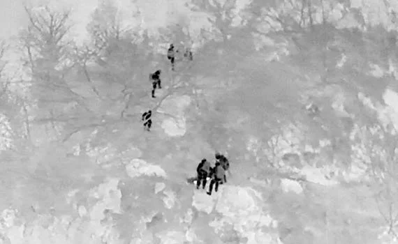
Dual-sensor payloads streamline workflows so you can locate missing persons in forests, mountains, open terrain, or after dark — while logging GPS-tagged footage for evidence or debrief.
What should I fly?
Drone: SwitchBlade-Elite — The SwitchBlade-Elite is easy to transport, set up, and tear down, which means you can quickly get where you need to be. For government or sensitive agencies, go with the Pro Package, which indicates Safe to Fly.
Payload: FLIR Hadron 640R — The thermal camera is sensitive enough to locate missing persons or animals, while the visible camera can provide situational awareness for mission planning and execution.
SwitchBlade-Elite + Sony ILX-LR1
Disaster Assessment
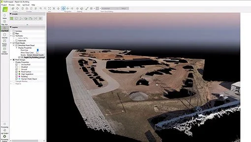
After floods, fires, or tornadoes, rapidly document structural damage and accessible routes before boots hit the ground. Add in a thermal camera and you have a full kit to help you effectively prioritize response and resources.
What should I fly?
Drone: SwitchBlade-Elite — Combine payload versatility with high endurance, and you can fly where and when needed.
Payload: Sony ILX-LR1 — High resolution images and real-time video give you the required speed of data-to-command.
Software: PIX4Dmapper — Create detailed point clouds for mapping and situational assessment.
Alternative bundle: SwitchBlade-Elite + FLIR Hadron 640R — Add thermal imaging to more easily spot missing persons or animals day or night, or find hotspots in infrastructure.
SwitchBlade-Elite + Sony ILX-LR1
Mapping Inaccessible Terrain
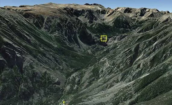
Generate accurate 3D models for asset management and leak risk detection using LiDAR or photogrammetry.
What should I fly?
Drone: SwitchBlade-Elite — Superior cruise speed and efficiency, along with payload swappability, combine to make the SwitchBlade-Elite a key tool that you need in your public safety toolkit.
Payload: Sony ILX-LR1 — Gets you the data you need, for the outcomes you need.
Accessories: Indefinite Flight Package — The Indefinite Flight Package (IFP) enables continuous flying, for all those mapping missions.
Other Use Cases
Whether you’re tracking a suspect, locating a missing hiker, or responding to a natural disaster, our UAVs help you cover more ground, stay safer, and make faster decisions from the air — without relying on helicopters or outsourcing.
Aerial investigation: Capture detailed aerial views of a crime scene, providing additional evidence or crime scene reconstruction.
Recommended bundle: SwitchBlade-Elite + Sony ILX-LR1
Surveillance: Get live views over events, protests, or high-traffic incidents to spot issues early and improve crowd flow and safety.
Recommended bundle: SwitchBlade-Elite + Sony ILX-LR1
Tactical overwatch: Use real-time video and thermal feeds to coordinate SWAT, patrol, or K9 units from a safe standoff distance.
Recommended bundle: SwitchBlade-Elite + FLIR Hadron 640R
Subdivision addressing for 911: When you need the details, you can see the details.
Recommended bundle: SwitchBlade-Elite + Sony ILX-LR1
Why do you need Vision Aerial
in your Public Safety Drone Toolbox
Built to work.
Your drone should work in the same conditions you do — wind, heat, altitude, poor visibility, trees or plains, and urban or rural settings.
Portable.
When minutes matter, you can get from case to airborne in under 2 minutes — no assembly, no warmup.
Versatile.
Swappable payload options let you adapt to what you need per call — thermal, high resolution, or zoom.
Safe to fly.
U.S.-designed, manufactured and supported platform with no backdoor data links.
FAQ
Can Vision Aerial drones be used at night?
Vision Aerial drones are capable of safely flying at night, but doing so requires specific certification. Under general Part 107 provisions, which are applicable to all drones, pilots are restricted to flying between dawn and dusk.
Do I need FAA approvals for public safety flights?
We support COA and Part 107 users, and can provide documentation and training to help you get approvals faster.
Can we stream live video to command centers?
Absolutely – we support encrypted video feeds that can be shared.


